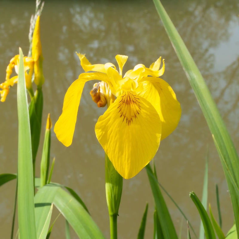
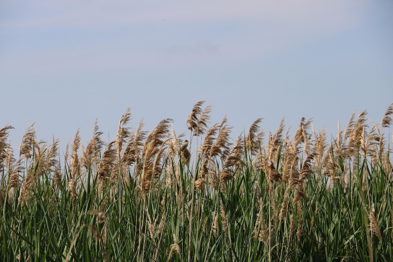
Common Reed
Phragmites australis
Primary species for the retention basin; removes nitrogen, phosphorus and suspended solids from agricultural runoff; binds soft alluvial clay banks with a dense rhizome mat.
A phased plan for flood resilience and slow tourism along the
Volturno — read as a single river running from coast to city.
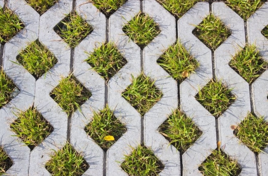
Cleaning green areas, installing simple infrastructure — benches, permeable pavement, street lights, wastebins — improving accessibility for the Via Domitiana staircase leading to the river, and implementing debris-collecting systems: a series of small-step interventions that can greatly impact the relationship between people and the river, while enhancing it and its surrounding environment.
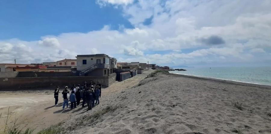
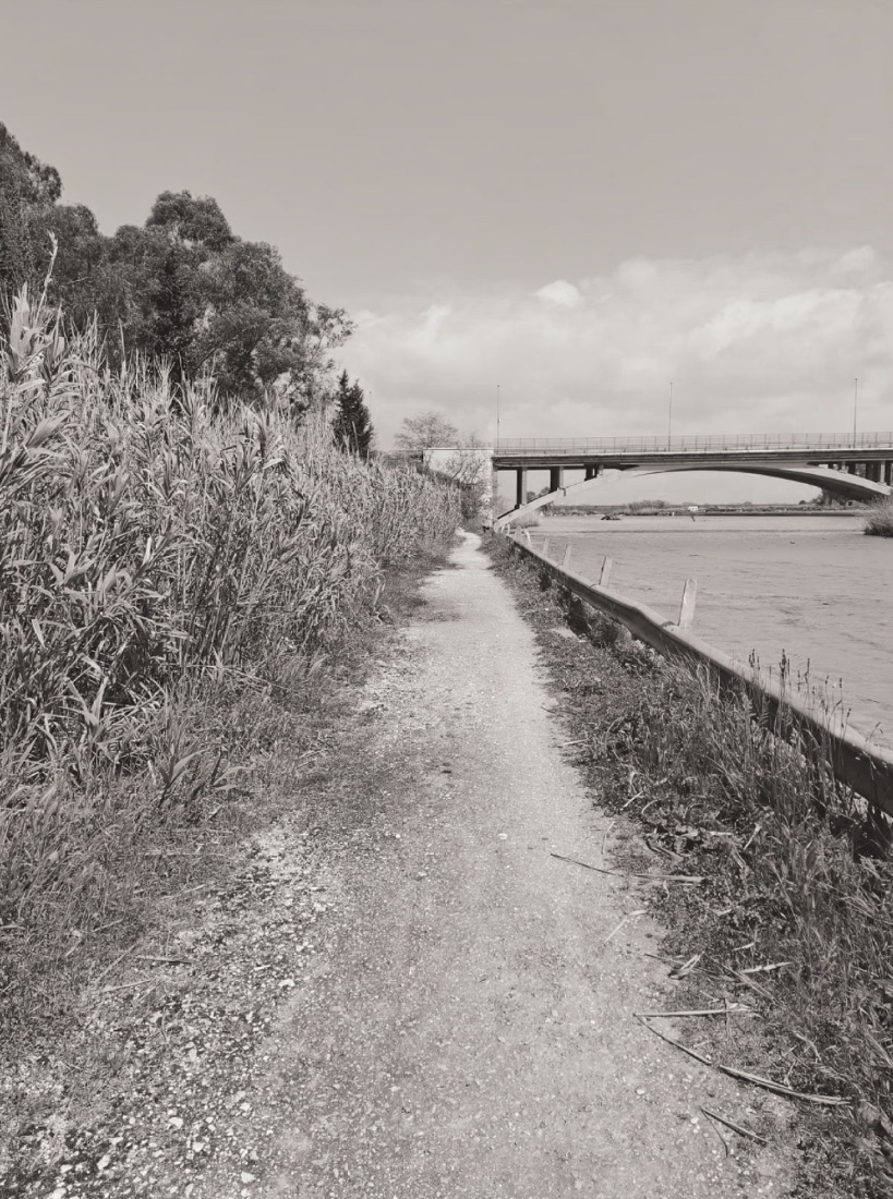
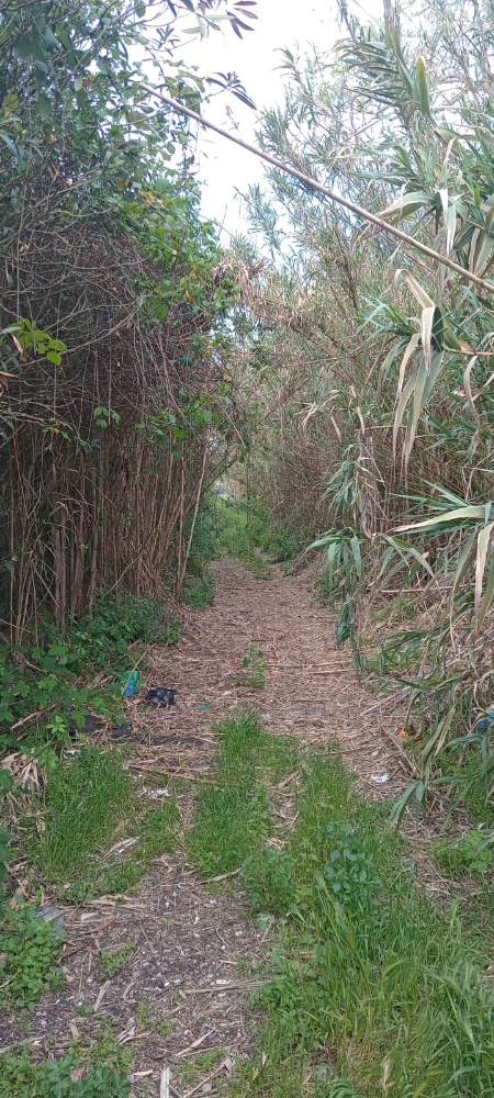
The journey begins at the river mouth, where small repairs can change how a town meets its water.
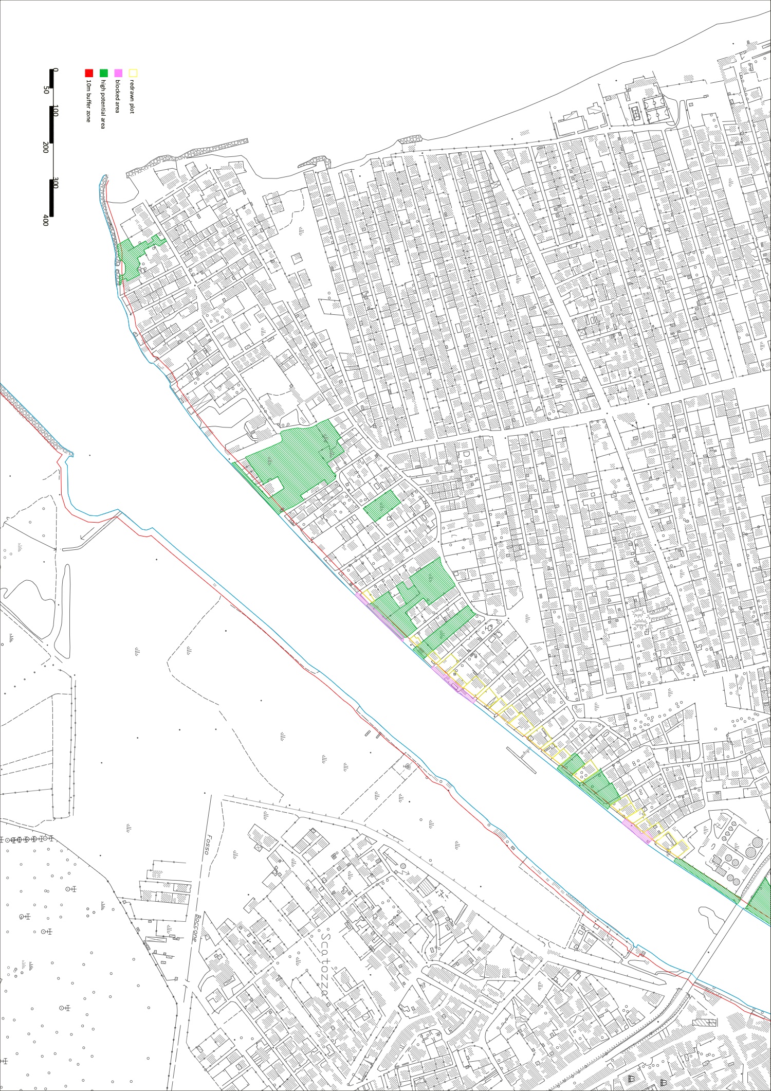
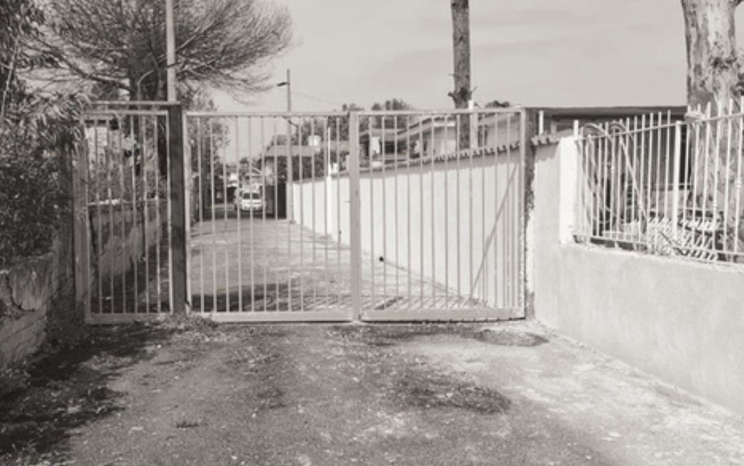
This map illustrates the current green areas on the river shore in Destra Volturno, which should be cleaned and improved for public use. The main access point to the river on Via Domitiana is dangerous and in poor condition; the informal passageway next to it, used daily by locals as a shortcut, needs to be rehabilitated.
three places on the shore — today, and as proposed · click any image to enlarge
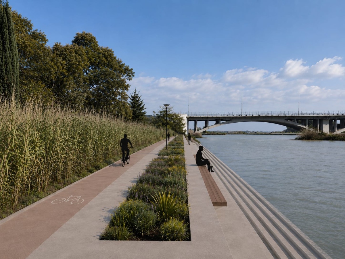
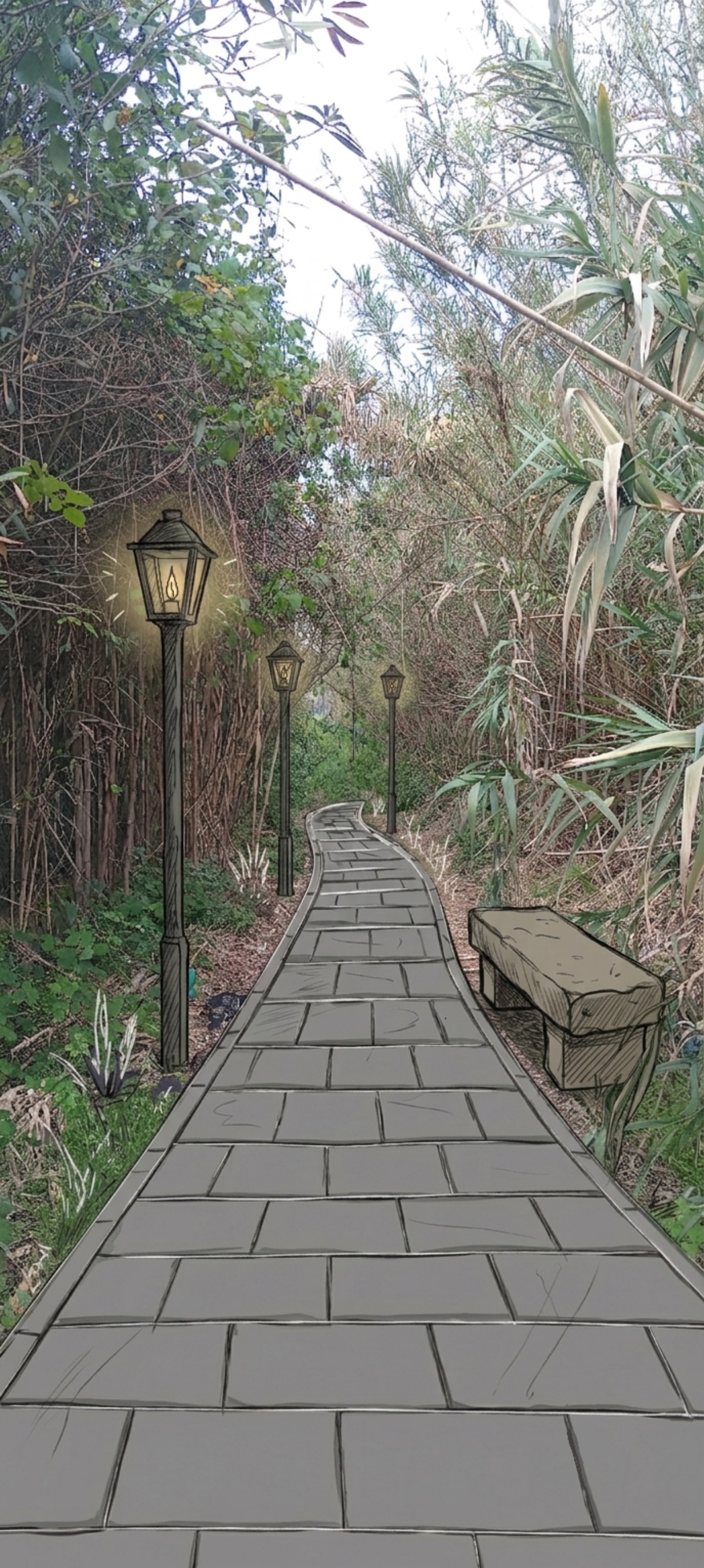
The riverside access becomes a walkable promenade
A rehabilitated informal passage to the water
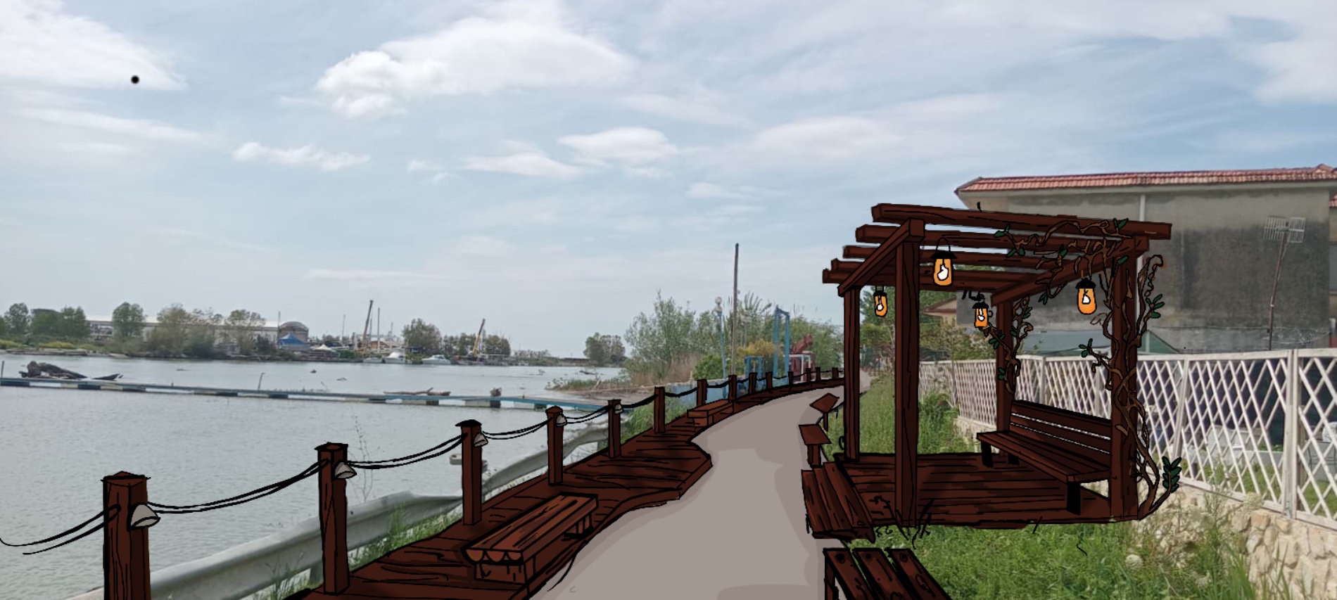
A fenced-off edge reopened as a timber boardwalk
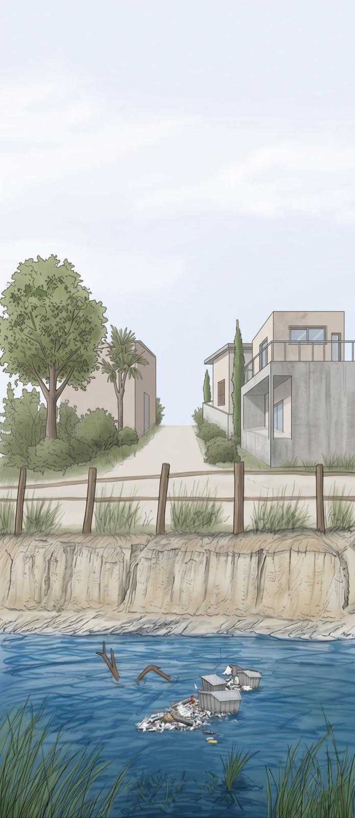
Inappropriate waste collection and illegal trash dumping have been seriously affecting the Volturno and its surroundings. Installing a floating debris-collection system is a priority that will improve aquatic life, restore the ecological properties of the river, and create a pleasant environment.
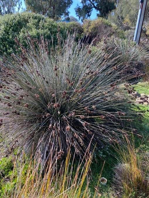
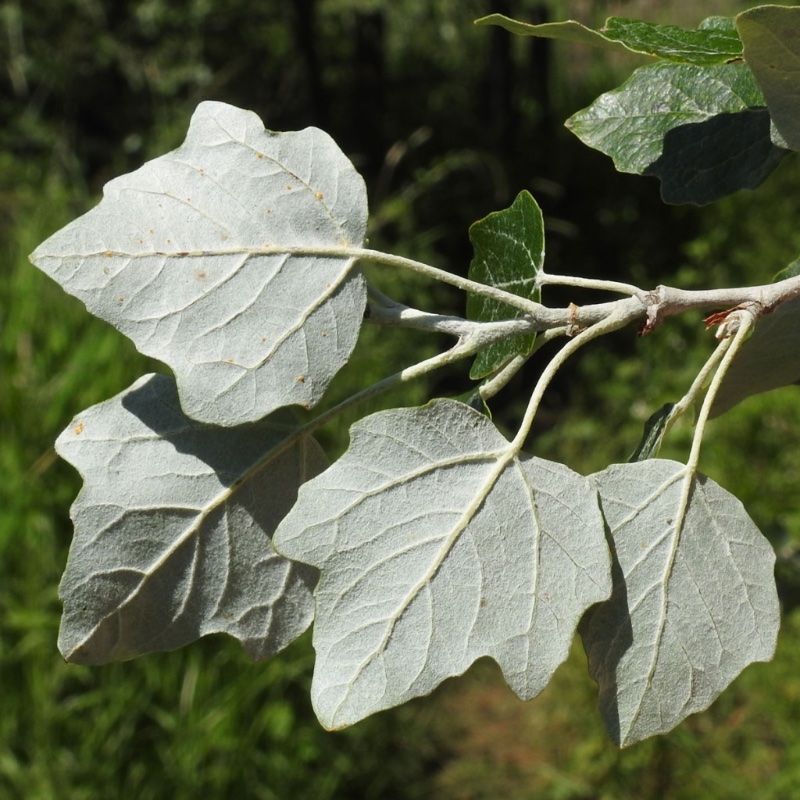
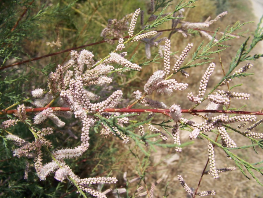
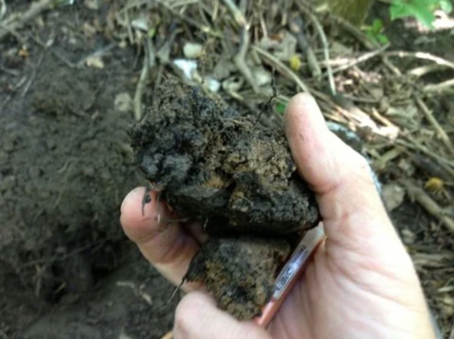
Understanding the area's biodiversity — vegetation and soil types, and which species can rehabilitate the environment — is a crucial early step. Species that combat flooding, stabilise soil and enrich the natural habitat can then be planted and maintained.
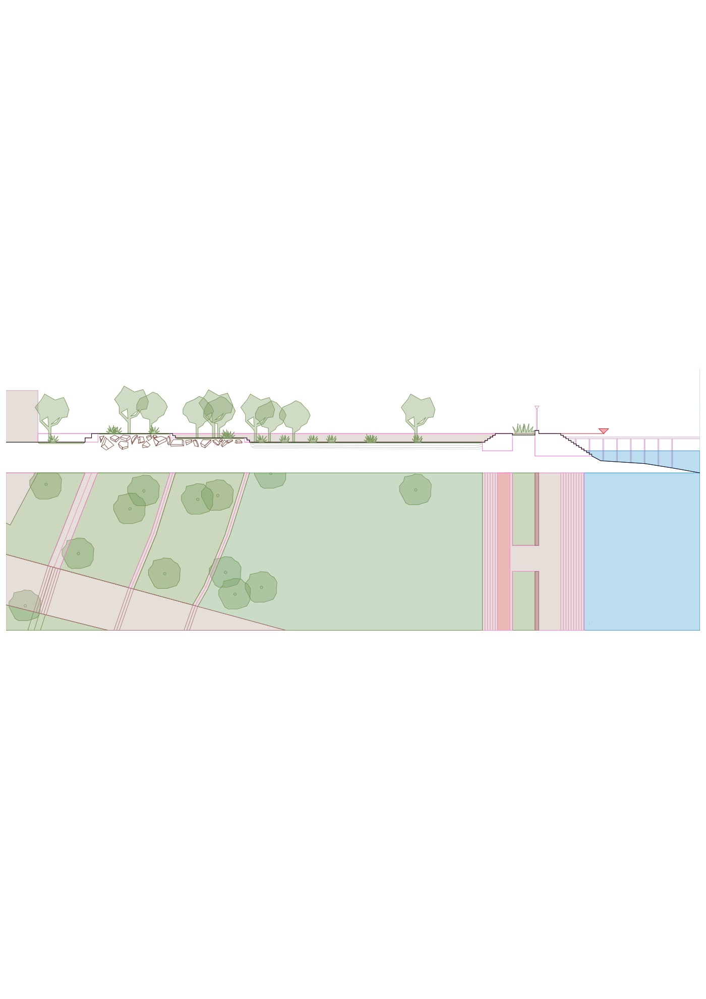
Begins in Destra Volturno with an elevated promenade — both a water barrier and a vegetated pedestrian alley — and the demolition of high-flood-risk buildings, then expands in scale to the ancient city of Capua, with the extension of the Ciclovia del Volturno and a 40 m buffer zone — transforming the Volturno into an ecological corridor for slow tourism.
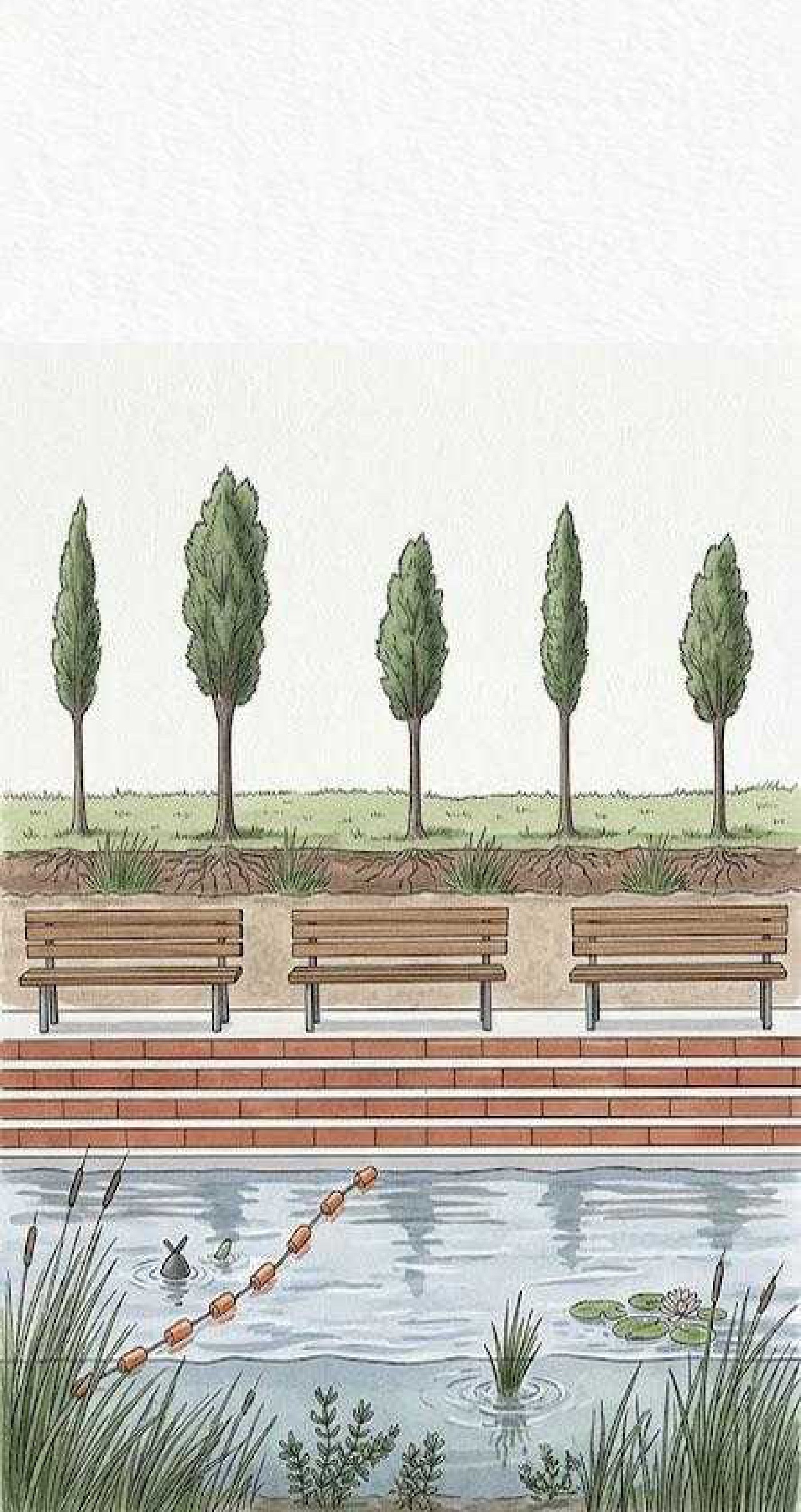
Elevated promenade concept (1.3 km) with two accessible sidewalks for pedestrians and cyclists, separated by a vegetation area that acts as a buffer zone against flooding.
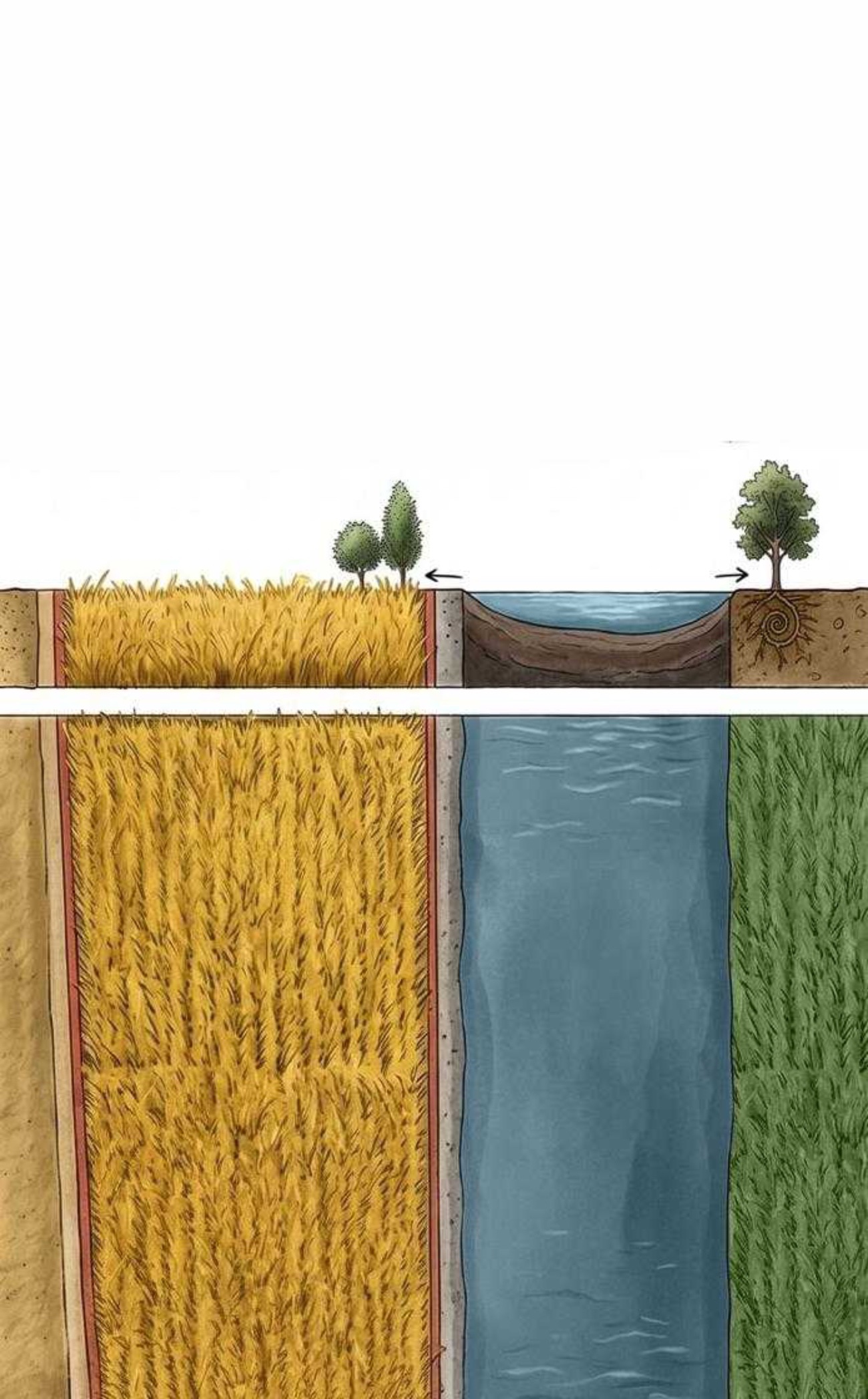
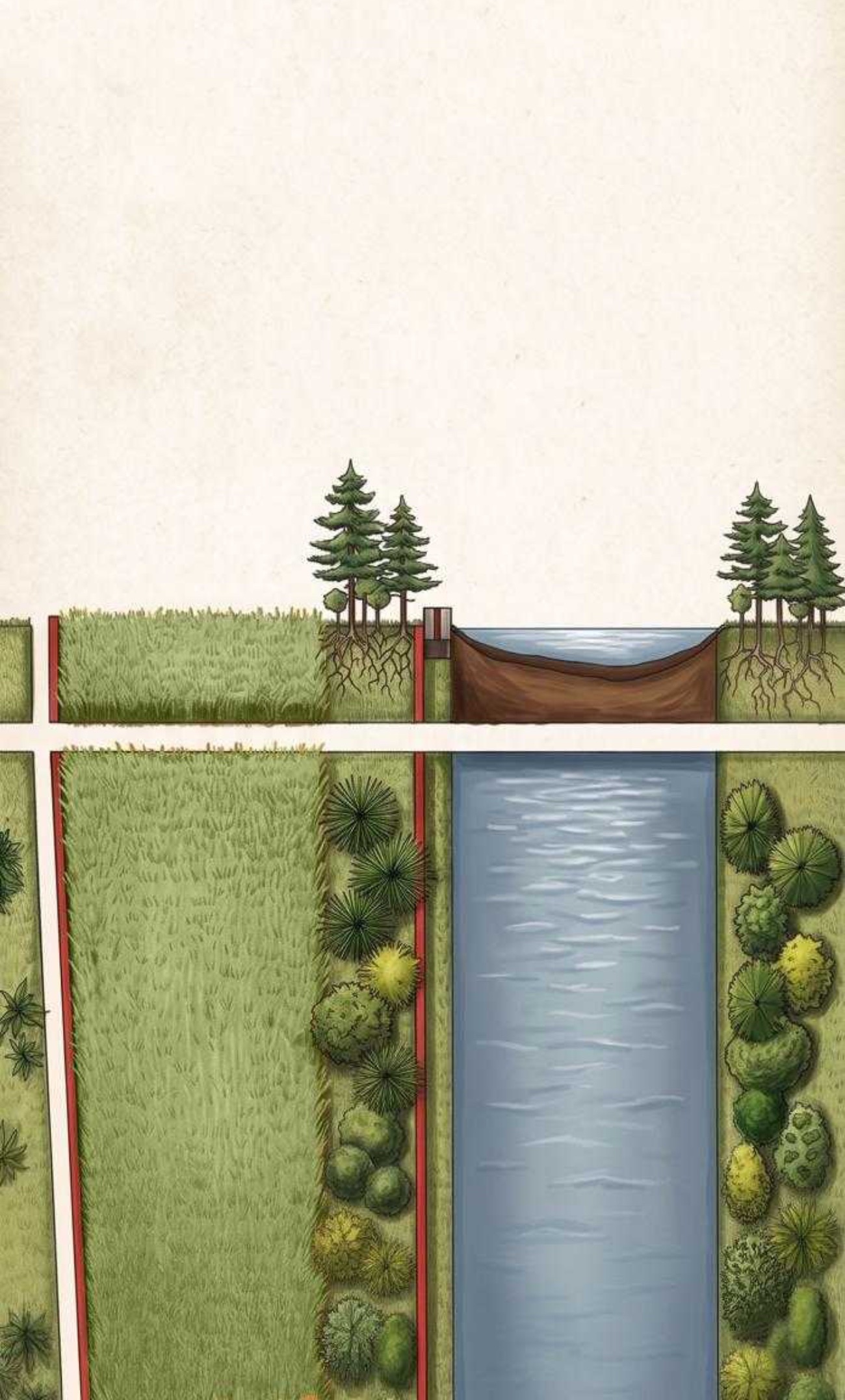
agricultural land · the wetland channel · the promenade
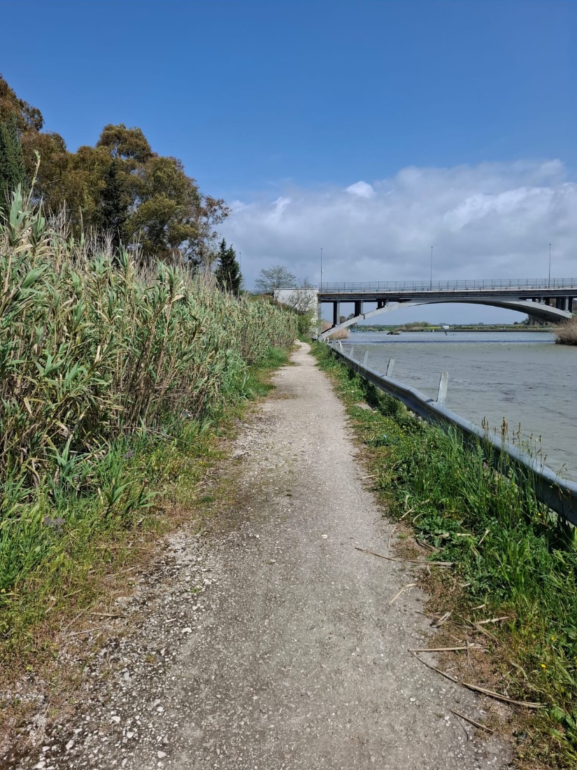
Photographs from the team's site visits along the river. Click any to enlarge.
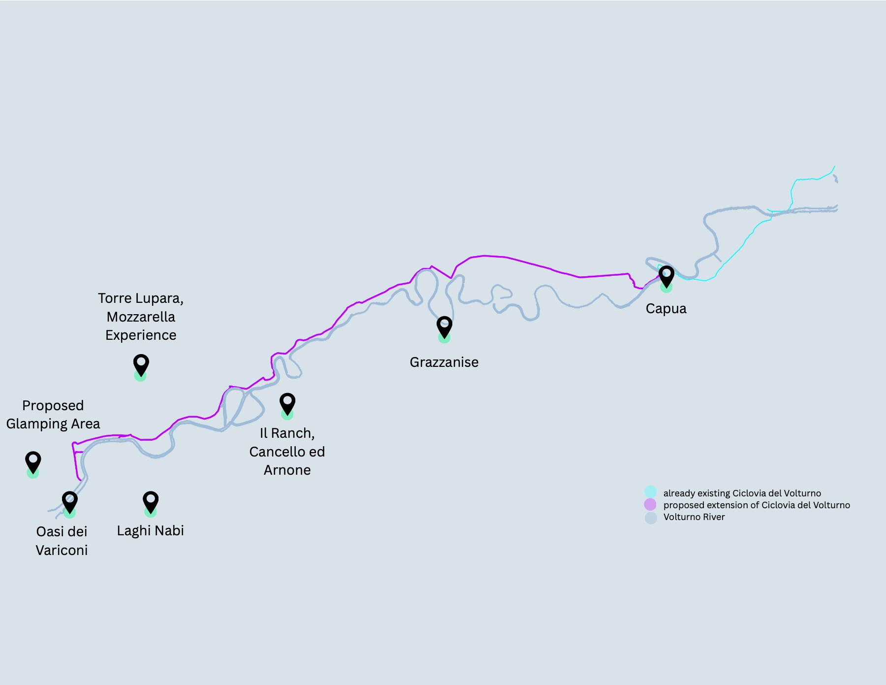
The extension of the Ciclovia del Volturno aims to bring more tourists to Destra Volturno and along the river — to discover its attractions and views, and to let locals reach the other riverside cities more easily.
tap a stop to read about it
{{ markerText }}
The next 50 years hold a bright future — finalising the elevated promenade, developing sponge parks along the Destra Volturno shore, and implementing floating wetlands and a lamination basin, for natural rehabilitation and flood prevention.
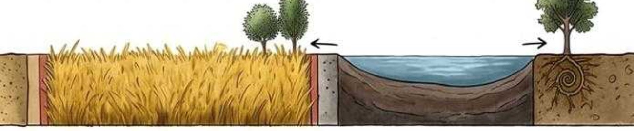
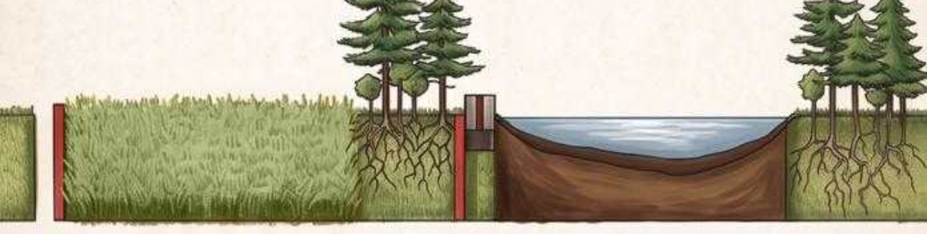
Sections showing how interventions protect settlements from flooding by retaining water between the debris berm and the promenade — the sponge-park concept.
drag the handle to compare the two futures
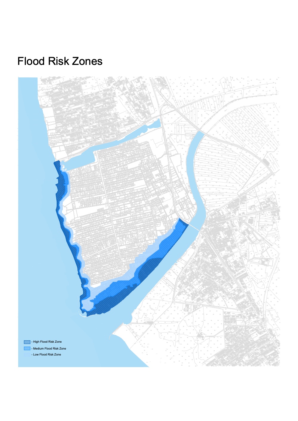
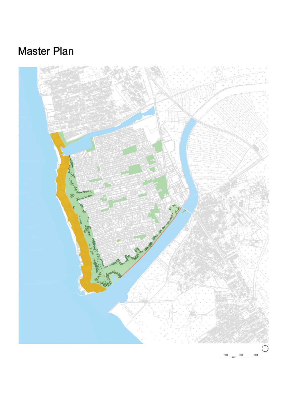
Paired flood projections for Destra Volturno over 50 years — blue shows high-to-low flood-risk zones with no intervention; the green-and-gold master plan shows the same shore protected by promenade, green areas and buffer.
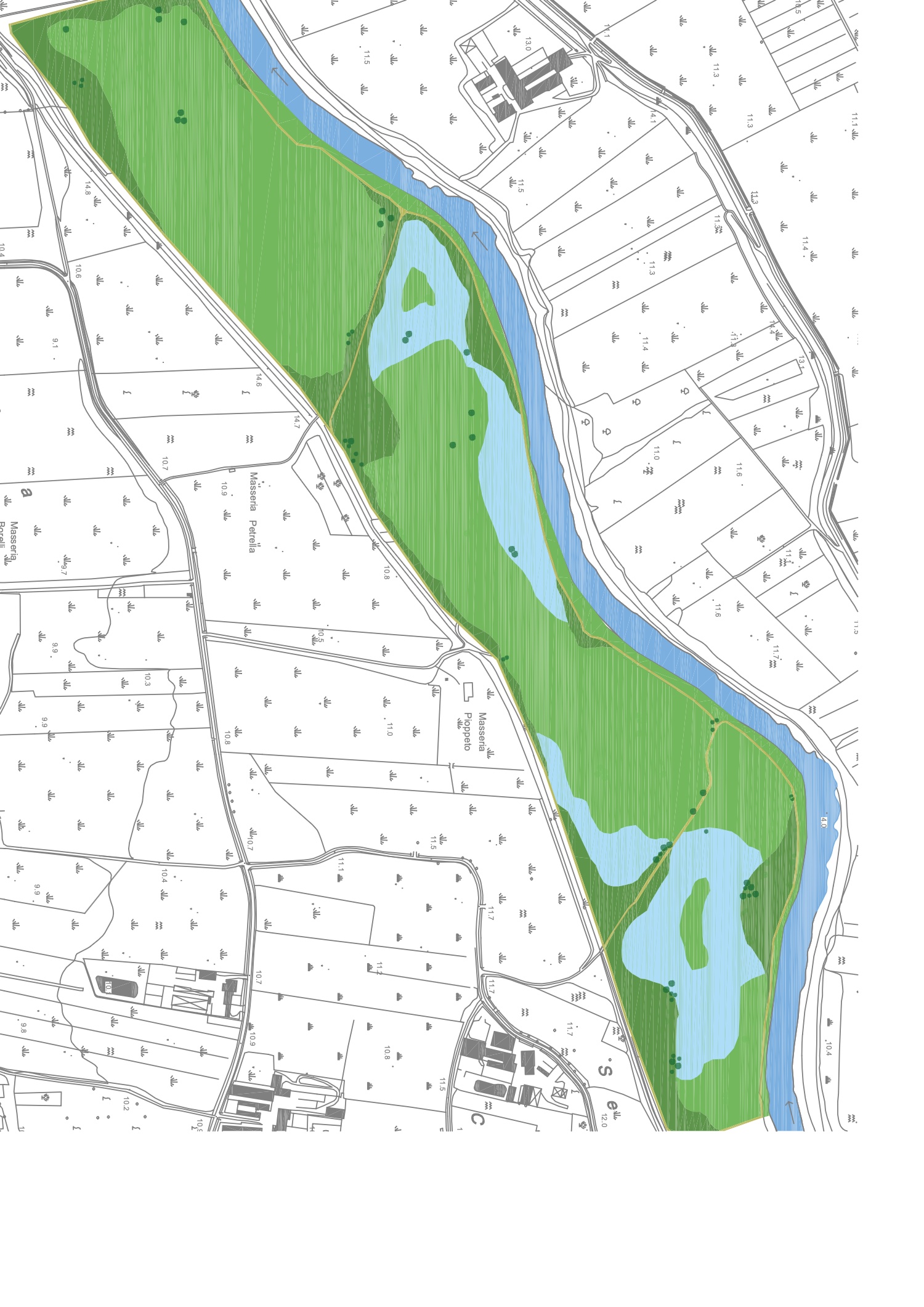
A proposed lamination basin within the 40 m buffer zone, in the agricultural lands between Cancello ed Arnone and Grazzanise — an accumulation area where flood water can be stored and later used efficiently for agriculture.
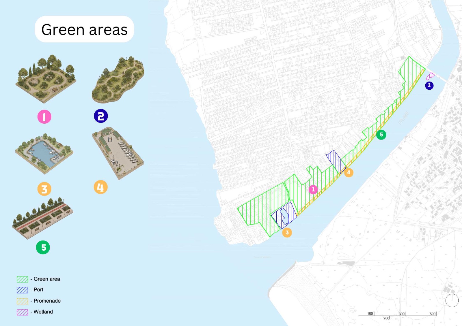
A visual depiction of the exact location of all new green areas on the Destra Volturno shore, with proposed designs including floating wetlands and the elevated-promenade trace.
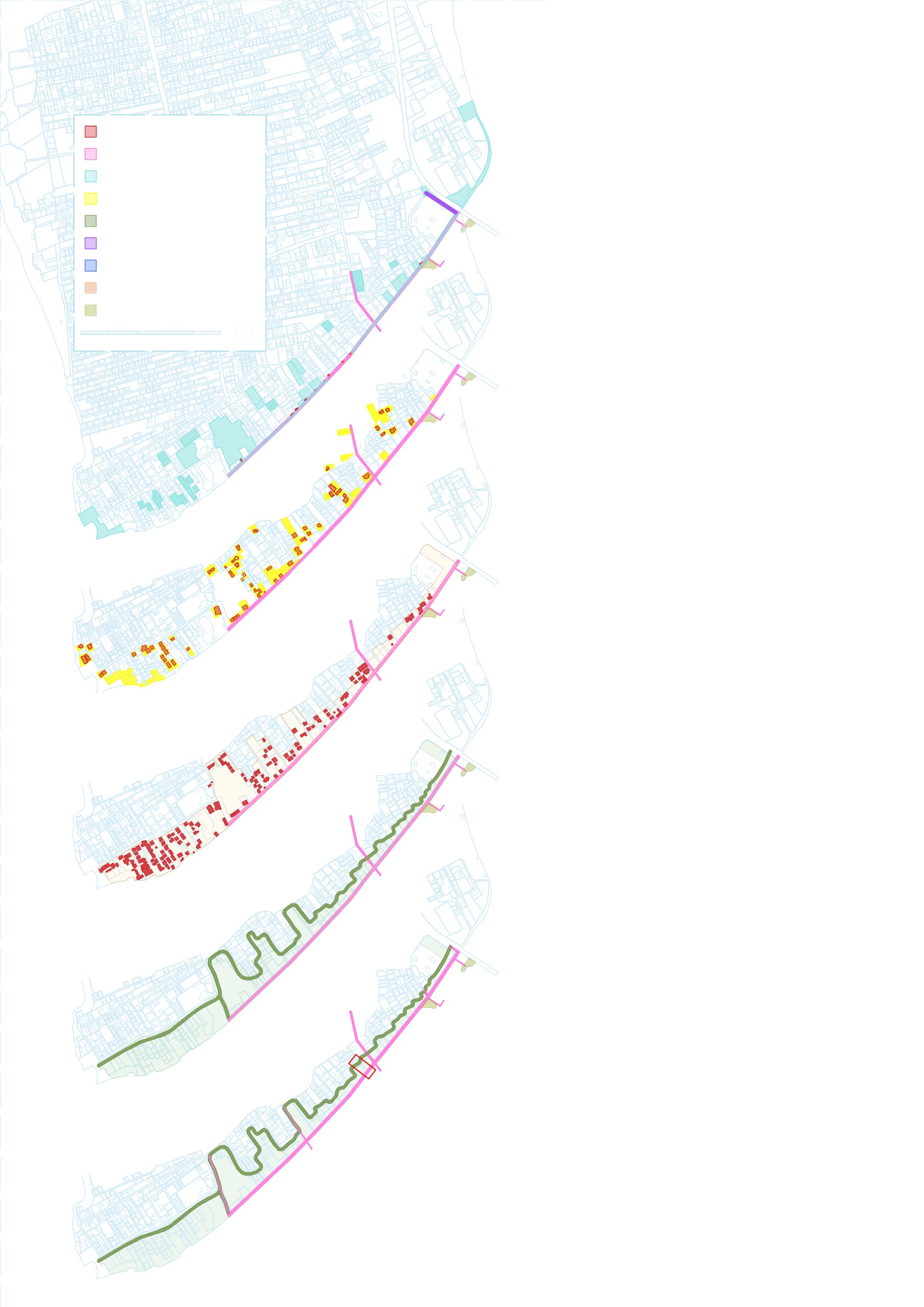
An exploded axonometry dissecting the 0–5, 5–20 and 20–50-year phases. It includes unoccupied buildings to be demolished in the high-flood-risk (10 m) zone, and currently-occupied buildings to be demolished with relocation — transformed into green, recreational areas.
The river that was a barrier becomes a promenade,
a corridor, a place to return to.
{{ lbCap }}